Line of Sight (Visibility)
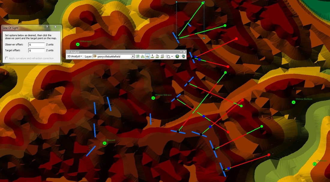
Figure 1: Line of Sight has been calculated from various positions of Union Regiments at 3:45 PM October 8, 1862 at Perryville.
This example uses the battlefield at Perryville.
Once the regimental positions have been established and elevation information has been created in a usable format a line of sight calculation can be created. The line of sight calculation will allow for the determination of whom could see whom, see Figure 1. On each Line of Sight line there are visible areas represented in green and hidden areas represented in red (these are the color the software utilizes). The black dot is the initial position of the observer. The text box on the left hand side of Figure 1 is used to apply an offset from ground level since we normally are not looking along the surface of the earth. If the soldier was standing a different visibility perspective would occur as opposed to if the soldier was laying on the ground or in an observation tower. A different view will occur for the viewer and the observed if their roles are reversed.
Once the regimental positions have been established and elevation information has been created in a usable format a line of sight calculation can be created. The line of sight calculation will allow for the determination of whom could see whom, see Figure 1. On each Line of Sight line there are visible areas represented in green and hidden areas represented in red (these are the color the software utilizes). The black dot is the initial position of the observer. The text box on the left hand side of Figure 1 is used to apply an offset from ground level since we normally are not looking along the surface of the earth. If the soldier was standing a different visibility perspective would occur as opposed to if the soldier was laying on the ground or in an observation tower. A different view will occur for the viewer and the observed if their roles are reversed.

Figure 2: 3D Analyst Toolbar
|
To produce a Line of Sight the 3D Analyst tool is used. Turn on the 3D Analyst Toolbar from the Customize Menu. The Toolbar should have an appearance like Figure 2. Make sure the layer name is visible in the pull down window.
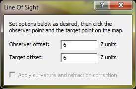 Figure 3: Offset Window
The Line of Sight tool is the button that the right arrow is pointing to in Figure 2. When this command is selected, a toolbox about the offset of the observer and the target will open, see Figure 3. These units are the same as the current projection; the observer position should not be zero, because that would mean the person would be lying flat on the ground. If the units used are unknown look at the property window under the source information or at the metadata using ArcCatalog. Click on the map at the position of the observer; in this example it was the location of specific Union regiments. Then click on the target location. A line will be drawn from the observer to the location of the target. Green sections of the line will represent visible locations and the red areas of the line are locations that cannot be seen by the observer. Repeat the operation, making the target the observer and the observer the target.
Viewshed/Visibility
The Viewshed and Visibility are tools located in the 3D Analysis toolbox under Visibility. Viewshed is used to determine what can be seen from either a set of point locations or lines. For example, an observer at one location will have a different visibility than an observer at another location. If only one location is used then a line of site calculation would be created, when multiple locations are to be integrated together for an overall result then Viewshed or Visibility tools are used. There are three required parameters for this operation:
- the elevation a raster (DEM or a Hillshade)
- a file containing either line or point data (observer position)
- an output file name and location
- Optionally an offset could be added, but it is much less likely for this tool to be used then in the line of sight.
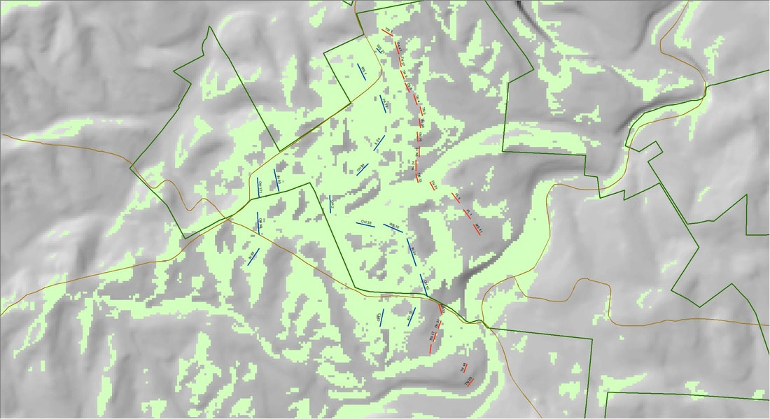
Figure 4: Viewshed and Visibility
In figure 4 the areas in green are visible to the Union troops (blue lines), the confederate forces are drawn in red. From this simple analysis there are Confederate troops that would not be visible to the union force. It is not correct to assume that one army has a specific view and that the other army has the same view, individual Viewshed operations would be created for each army.
